
Satellite Images Reveal Mangrove Loss Heightening Karachi’s Flood Risks
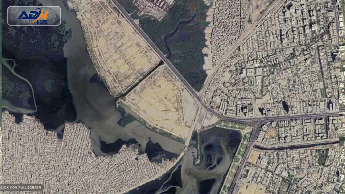
KARACHI: Recent satellite imagery from the Space and Upper Atmosphere Research Commission (Suparco) highlights a significant transformation along Karachi’s coastal zone, particularly near the Mai Kolachi Bypass, where mangrove forests and natural tidal creeks have been increasingly replaced by reclaimed land and urban development from 2000 to 2025.
The analysis indicates that areas once dominated by lush mangrove cover are now characterized by urban plots, raising concerns about the ecological balance and flood resilience of the region. Suparco’s report emphasizes that this shift not only alters the landscape but also impacts the local biodiversity and the natural defenses against coastal erosion.
This alarming trend poses serious implications for Karachi’s residents, as the loss of mangroves diminishes the city’s ability to mitigate flooding and erosion risks, particularly during monsoon seasons. Experts warn that without immediate intervention, the city could face increased vulnerability to climate-related disasters, affecting thousands of lives and livelihoods.
In response to these findings, environmentalists and local authorities are urged to prioritize the restoration of mangrove ecosystems and implement sustainable urban planning practices. Upcoming discussions among policymakers and environmental groups are expected to focus on strategies to combat this pressing issue and enhance Karachi’s resilience against climate change.